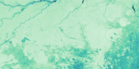
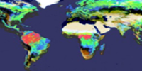
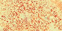
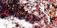
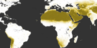
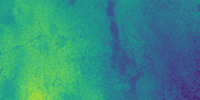
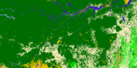
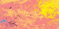
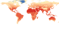
Global vegetation dynamics
Annual bias and trend-corrected metrics on intra-annual vegetation dynamics expressed through the NDVI
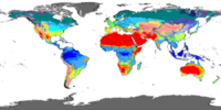
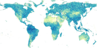
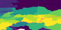
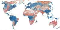
Global climate classification
High-resolution climate classification following the Koppen-Geiger class cheme.
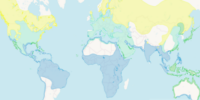
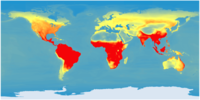
Range maps of bird species
Range maps of bird species provided by the Birdlife initiative
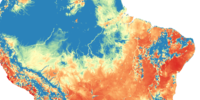
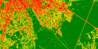
Cumulative Basin Metrics (CBM)
Mean values of selected metrics aggregated dow-/upstream
Bias-corrected CCI land cover
Trend-corrected CCI land cover dataset with annual and global data on per-pixel percentages of 27 classes.

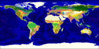
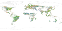
CCI land cover
Global, yearly land cover derived in the context of the Climate Change Initiative (CCI), from 1992 to the present
CCI land cover history
Historical maximum extent of generic land cover types derived from the CCI land cover dataset
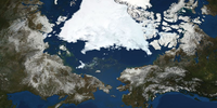
Annual permafrost extents
Time-series of the extent of permafrost in the northern hemisphere
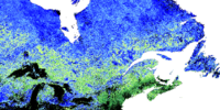
Global snow cover densities
Annual time-series on per-pixel proportions of snow cover

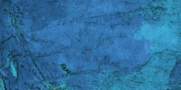
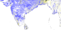
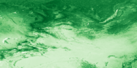
Annual soil moisture
Global intra-annual metrics on the variability of soil moisture content from 1978 to the present
Global soil moisture history
Historical metrics on the spatial and temporal variability of soil moisture since 1978

Global high-resolution climate
Global monthly time-series of precipitation and temperature.
Global high-resolution climatologies
Global time-series of climate variables
Global demographic data
Database on human demography collected at multiple scales, from microdata to national census
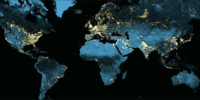
Annual nighttime lights
Global time-series of Nighttime light intensities mapped by the Defense Meteorological Satellite Program (DMSP)

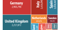
Economic indicators
Global database on economic indicators obtained at multiple scales, from microdata to international reports

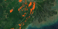
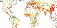
Annual Fire frequency
Global time-series on the intra-annual frequency of fires
Global fire regime
Characterization of the frequency and recurrence of fires
Annual streamflow dynamics
Global time-series on the intra-annual variability of the land surface streamflow

Fused vegetation continuous fields
Annual and global Vegetation Continuous Fields (VCF) that fuses data from Copernicus, MODIS, and AVHRR
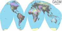
Global administrative boundaries
Global database with an up-to-date delineation of administrative areas
Global impervious surfaces
Annual time-series of impervious surfaces

Reptile range maps
Global Assessment of Reptile Distributions (GARD)
Global bare land
High-resolution map of the global extent of bare land as of 2010
Global ocean bathymetry
General Bathymetric Chart of the Oceans (GEBCO)
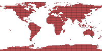
Global tiling system
Delineation of equally sized tiles for high-performance computing

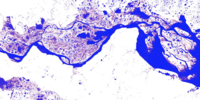
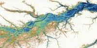
Global floodplains
Maximum extent of the 200-year floodplains

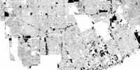
Global human settlements
Multi-temporal characterization of human settlements distinguishing types of land use (e.g. urban, rural), counting population, and identifying built-up structures.
Gobal mininng operations
Delineation of mining operations observed between 2000 and 2017
Annual Area of Habitat (AoH)
Global and species-specific layers on the area of habitat mapped on a species-by-species basis.
Annual ecosystem areas
Global, per-pixel areas for 71 ecosystem types

Annual ecosystem diversity
Global time-series on ecosystem diversity metrics
Global land use database
Multi-temporal database with statistics on agricultural production and land use

Global livestock area
Gridded Livestock of the World (GLW) database, reflecting the most recently compiled and harmonized subnational livestock distribution data for 2010.
Global livestock counts
Gridded Livestock of the World (GLW) database, reflecting the most recently compiled and harmonized subnational livestock distribution data for 2010.

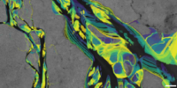
Global geomorphology
High-resolution geomorphological variables

Global mountain inventory
Delineation of indiviudal mountains
Global mountain classification
Global Mountain Maps
Global classification of river networks
Classification of water bodies connected to river networks
Global surface water
Annual time-series on permanent and seasonal surface water
Global surface water history
Historical metrics on Surface water dynamics

Global hydrological basins
Deliniated of watershed at different hierarchical levels
Global forest cover dynamics
Annual time-series on forest canopy densities over nearly three decades
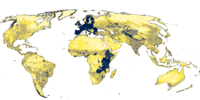
Annual population counts
Global per-pixel counts of human populations

Bias-corrected global surface water
Annual, gap-filled, and trend-adjusted Global Surface Water
Land surface phenology
Typical phenology of deciduous forests derived with PROBA-V data time-series
Global database on land ownership
National-scale land tenure data
Global distance maps
Maps of linear distance to different land features
Annual Landsat data quality
Landsat acquisition quality mapped on a yearly basis

Annual commodity areas
Global time-series of per-pixel areas on individual crop types and other land uses.
Global commodity probabilities
Annual probability layers for different agriculture commodities
Reference data on land use and cover
Global ground-truth database on land use and land cover
Land cover of Brazil
Annual and high-resolution land cover of Brazil
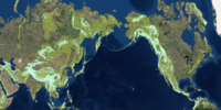
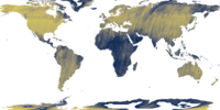
Global elevation
Multi-Error-Removed Improved-Terrain (MERIT) Digital Elevation Model (DEM)
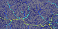
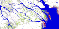
Global rivers
Hydrological variables derived with the Multi-Error-Removed Improved-Terrain (MERIT) Digital Elevation Model (DEM)
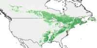
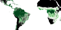
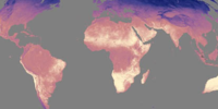
Global Normalized Difference Vegetation Index (NDVI)
Global, annual, NDVI metrics derived with MODIS
Global pixel areas
Per-pixel areas for global applications
Range maps
Species range maps harmonized from different sources
Soil climatologies
Soil temperature bioclimatic variables
Soil characteristics
Gridded soil database (soilGrids)
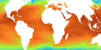
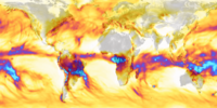
Global Sea surface temperature
Annual maximum Sea Surface Temperature (SST)
Annual water balance
Global climate and water balance time series.
Global map of tidal flats
Global distribution of tidal flats

Tropical moist forest cover
Annual tropical moist forest cover densities

Travel time to the nearest city
Global map of travel time disparities
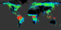
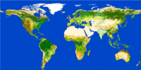
Global Vegetation Continuous Fields
Vegetation Continuous Fields (VCF) derived with AVHRR
A product of
Funded by